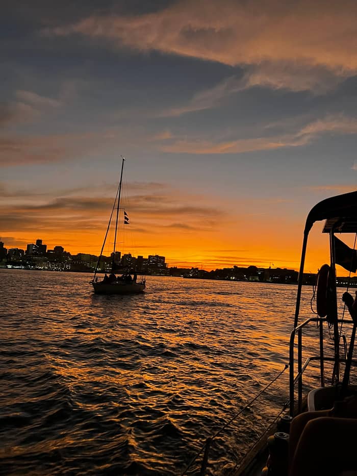
Skyline
The Rio shore
Flamengo to Urca
- HighlightSugarloaf from below
- History1565 founding site7
- LightBright on the way out
Guides
Language
Currency
Check datesfrom $57 · cancel for freePick out your stop
Sunset sail on Guanabara Bay
★ 4.8 · 1,051 opinions
Answer in brief
A Rio de Janeiro boat tour on the sunset sail loops from Marina da Glória past Sugarloaf to the Santa Cruz da Barra fortress and Boa Viagem Island in Niterói, then back past Santos Dumont Airport.
On the route
Map of 21 stops
Select a route, then press a pin or stop to read its note and open Google Maps.
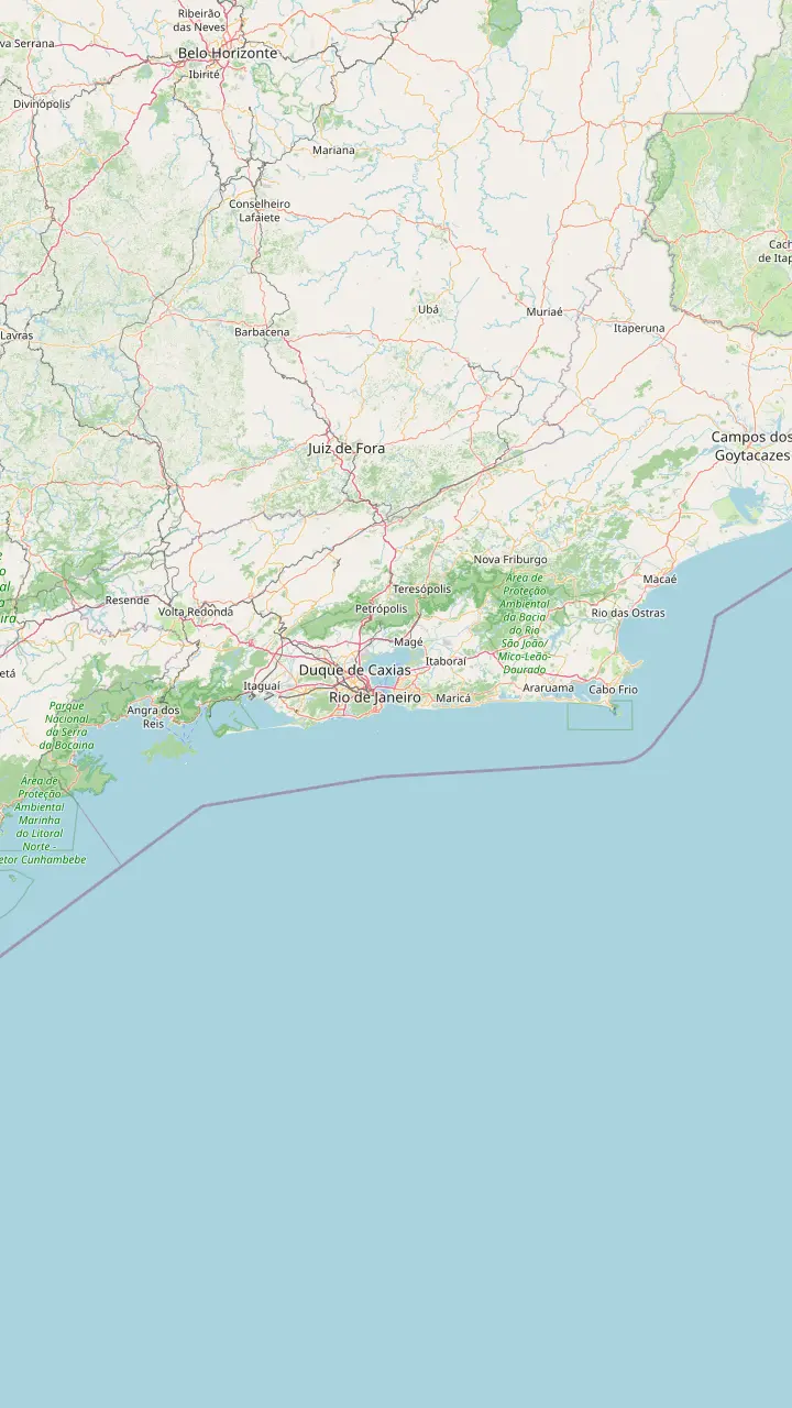
Where the sunset sail starts: the crew meets guests at the security gate. Riotur lists it as the Olympic sailing venue of 2016.
Google MapsA federal natural monument about 5 km off Ipanema, home to some 10,000 frigatebirds.
Google MapsIslands 2 km off the coast with turtles and dolphins; snorkel trips run from Barra.
Google MapsAngra lies 160 km from Rio; fast boats reach Ilha Grande in about 40 minutes.
Google MapsWhere the fast boats from Angra dos Reis arrive on Ilha Grande.
Google MapsThe Blue Lagoon stop of the Angra and Ilha Grande day from Rio.
Google MapsArraial do Cabo, 140 km from Rio, where boat rides head for Farol Beach.
Google MapsBúzios, a little more than 170 km from Rio, with 23 beaches and daily boat tours.
Google Maps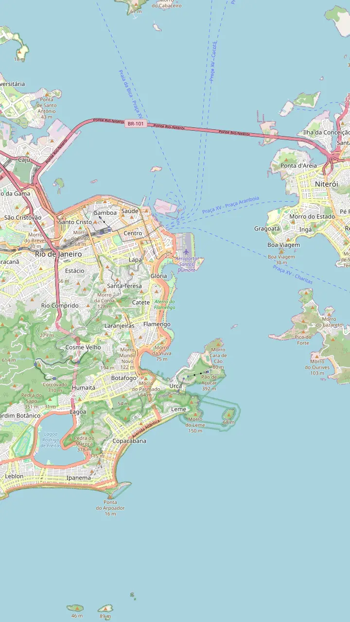
Where the sunset sail starts: the crew meets guests at the security gate. Riotur lists it as the Olympic sailing venue of 2016.
Google MapsThe central airport for domestic flights; the sail ends with a 10-minute stop beside its runway.
Google MapsThe waterfront park that runs from Santos Dumont to the start of Botafogo beach.
Google MapsThe curved cove between Flamengo and Urca, framed by Sugarloaf on the way out.
Google MapsA 15-minute photo stop below the granite peak, which rises 396 meters above the sea.
Google MapsPart of the São João fortress at Urca, where IPHAN places the founding of Rio in 1565.
Google MapsThe islet in the channel where Villegagnon landed first, before the tide drove him further in.
Google MapsAbout 30 minutes here on the sail, with an optional swim; IPHAN dates its construction to 1578.
Google MapsA 30-minute photo stop by the chapel that sailors visited since 1650.
Google MapsNiemeyer's saucer on the Boa Viagem headland, opened on 2 September 1996.
Google MapsThe statue stands on Corcovado, 709 meters above sea level, and shows as a silhouette at dusk.
Google Maps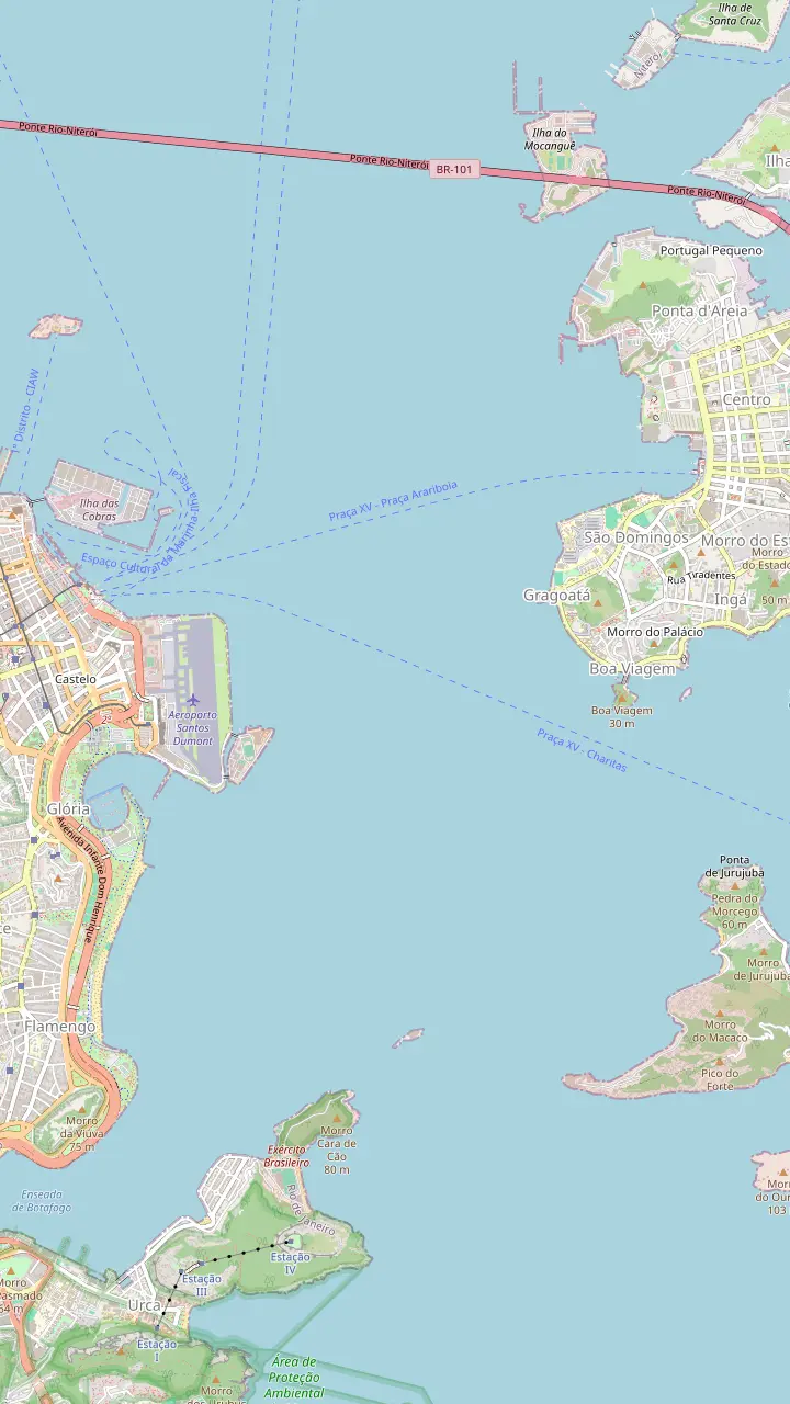
The central airport for domestic flights; the sail ends with a 10-minute stop beside its runway.
Google MapsA 15-minute photo stop below the granite peak, which rises 396 meters above the sea.
Google MapsPart of the São João fortress at Urca, where IPHAN places the founding of Rio in 1565.
Google MapsThe islet in the channel where Villegagnon landed first, before the tide drove him further in.
Google MapsAbout 30 minutes here on the sail, with an optional swim; IPHAN dates its construction to 1578.
Google MapsA 30-minute photo stop by the chapel that sailors visited since 1650.
Google MapsThe island of the last ball of the Empire, held in 1889; reached by schooner in about 10 minutes.
Google MapsNamed after the French commander who sailed into the bay on 10 November 1555.
Google Maps13.29 km long, 8.83 km of it over the bay, opened on 4 March 1974.
Google MapsMap data from © OpenStreetMap contributors
A Rio de Janeiro boat tour shows the city the way the first sailors saw it. Here is the sunset route stop by stop, the landmarks on each shore and where to sit for the photos.
Editorial team, riosunsetsail.com · Updated November 11, 2026 · Read in 8 min
The essentials
A Rio de Janeiro boat tour on the sunset sail traces a loop across the entrance of Guanabara Bay. The listing sets it out plainly: 40 minutes of cruising on the bay, a 15-minute photo stop at Sugarloaf, 30 minutes by the Santa Cruz da Barra fortress with an optional swim, a 30-minute photo stop at Boa Viagem Island, 25 minutes of views on the way back and a 10-minute stop by Santos Dumont Airport.
In practice that means you see both shores of the bay in one evening. The Rio side gives you the airport, the green Flamengo waterfront, the curve of Botafogo and the granite domes of Urca and Sugarloaf. The Niterói side gives you the old fortresses, the chapel on Boa Viagem Island and the white saucer of the contemporary art museum. The map further down this page marks each place; tap a pin to read what it is.
The order can change. The itinerary is subject to the weather and to the captain's call, and the swim stop in particular depends on wind, currents and rain. Treat the route as the plan for a calm evening rather than a fixed timetable. On a breezy day the crew may shorten one leg and linger on another, usually to keep the boat comfortable and the sunset in view for everyone on board.
The landmarks
| Landmark | Shore | What it is |
|---|---|---|
| Santos Dumont Airport | Rio | Central domestic airport4 |
| Sugarloaf | Rio | Granite peak, 396 m6 |
| São João fortress | Rio (Urca) | Site of the 1565 founding7 |
| Laje fort | Mid-channel | Islet where Villegagnon first landed8 |
| Santa Cruz da Barra | Niterói | Fortress begun in 15789 |
| Boa Viagem Island | Niterói | Chapel dating back to 165010 |
| Contemporary Art Museum | Niterói | Niemeyer building, opened 199611 |
| Rio-Niterói Bridge | North | 13.29 km long12 |
Dates and heights as the heritage institute IPHAN, Riotur, the city of Niterói and ANTT give them.9,6,10,12
This Rio boat tour starts at Marina da Glória, which the marina operator places close to the city center and right beside Santos Dumont Airport.1 Riotur places the marina inside Flamengo Park, and lists it as the venue where Olympic and Pan American sailors raced in 2016 and 2007.2,3 As the boat clears the breakwater, you are on the very water those crews used as a racecourse. Look back as you leave for a view of the marina against the hills.
Santos Dumont is the airport in the heart of Rio, with a central location and domestic flights, according to the federal government's guide to the city.4 From the deck it is a strange and memorable sight: a runway that runs almost to the waterline, with jets lifting off over the bay. The sail ends with a short stop by the airport, so keep your camera ready for a takeoff on the way home.
Behind the marina stretches the Aterro do Flamengo, the waterfront park that Riotur says runs from Santos Dumont to the start of Botafogo beach.5 From the water you see its gardens and palms as a low green band beneath the apartment towers. Further south the Botafogo cove opens up, framed by Sugarloaf, one of the classic postcard views of the city and a good first photo of the evening.
Where the time goes
Minutes for each leg as the listing states them; the captain may change the order with the weather.
Sugarloaf is the first stop. Riotur gives its summit as 396 meters above sea level and notes that its cable car opened in 1912, the first in Brazil.6,15 From the water you see the rock from its base, where the granite drops straight into the sea, and the cable cars look like small beads sliding along a thread between the summit and Morro da Urca, the lower hill where the first stage of the ride stops.
At the foot of Urca, on the point that marks the Rio side of the bay mouth, stands the São João fortress. The national heritage institute IPHAN identifies this headland as the spot where Portuguese settlers set up the city in 1565, when they came to drive out a French colony.7 Its building went on for almost 300 years, between 1602 and 1864, and the Army still uses it today.16 From the deck you can see its walls running along the waterline.
IPHAN also points out that only 2 fortresses in Brazil, São João and Santa Cruz da Barra across the water, keep the style of casemate battery for horizontal defense.17 From the boat you can see the low gun ports set into the stone, facing each other across the channel like a pair of guards at a gate. It is a reminder that this beautiful entrance was, for centuries, a heavily defended gateway to the colony.
Choose your view
Pick the sight that matters most to you.
If The bay mouth forts and a sunset
The sunset sail
Its route stops at Santa Cruz and Boa Viagem Island.
If The same route in morning light
The morning sail
A daytime loop of 3 hours to Boa Viagem Island.
If Copacabana and the Cagarras islands
A speedboat beach tour
It passes Copacabana, Arpoador and the Cagarras.
If A short, cheap look at the bay
The catamaran
A 1.5-hour circuit from Urca.
Pick a shore
Skyline
Flamengo to Urca
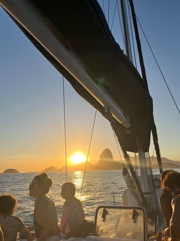
Fortresses
Laje and Santa Cruz
Chapel and museum
Boa Viagem headland
See the sunset sailBetween the shores, a small fort called the Laje crowns a rock out in the channel. An old city guide republished by the National Library of Brazil tells how the French commander Villegagnon landed first on this islet, almost level with the sea, before moving to a larger island further in.8 The rock is still there, crowned with old walls, and on a calm evening you can make out the surf breaking around it.
On the Niterói shore rises the Santa Cruz da Barra fortress, where the sail spends about 30 minutes. IPHAN dates its first works to 1578 and ranks it, by the early 18th century, as the biggest fort anywhere in Portugal's American colony.9,36 Riotur gives an earlier date, 1555, for its hand-cut stone walls.37 Both dates come from official bodies, so we give both rather than pick one. Its pale walls follow the shape of the rocks.
Riotur counts 45 guns on site, cast in the 18th and 19th centuries, and dates its small chapel to 1612.13 It also stands by the entrance channel that every ship bound for the port of Rio must pass.14 Until the 1950s, IPHAN says, any ship's passenger landing in Brazil sailed past its soldiers, so your route traces the old way into the country.38 The optional swim stop is listed here too, if the sea allows it.
Price the view
Choose a boat, then set your group size.
Review 4 options
Choose a boat, then set your group size.
≈
View≈
View≈
View≈
ViewAll amounts are from-prices on GetYourGuide, converted at the ECB reference rate. Exact prices are shown at booking.
Stop by stop
Start
Meet at the security gate, 15 minutes early.
40 minutes
Out past Flamengo and Botafogo.
15 minutes
A photo stop below the rock.
30 minutes
The fortress, with an optional swim.
30 minutes
A photo stop by the chapel.
25 minutes
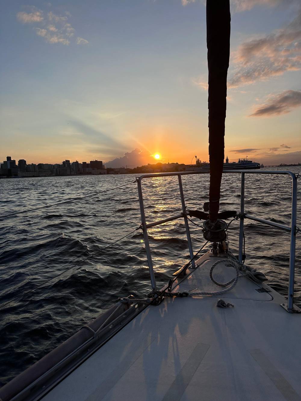
Sunset over the city on the way back.
Across the bay, the sail stops for about 30 minutes at Boa Viagem Island. Niterói's city government says a chapel has stood here since 1650, and that seafarers came to it to give thanks after a safe crossing.10,39 French attackers wrecked it in 1711; the neoclassical church you see from the deck went up in its place in 1780.40 It is one of the quieter moments of the evening, with the city across the water.
At the island's reopening, Niterói's archbishop recalled that an image of the Virgin once stood outside the church, and that everyone passing by boat would stop to honor it before sailing on.41 Today you can still see the small white chapel above the rocks. On land the island receives visitors from 10 AM to 5 PM except on Mondays, free of charge, which makes it a good extra for a day in Niterói.34,35
Just behind the island, on the Boa Viagem headland, sits the Niterói Museum of Contemporary Art. The city records that it opened on 2 September 1996 to a design by Oscar Niemeyer, who reportedly said it would look like a bird landing or a flower sprouting.11,42 From the water the building appears to float above the cliff, and the evening light on its curved white walls makes a memorable photograph.
Video
DDRio Dream Destination Rio on YouTube · The video only starts loading on your tap.
The fortress is located by the entering canal of the Guanabara Bay, where all the ships that come to the Rio de Janeiro port pass through.
On deck
Further into the bay, beyond the route of the sunset sail, lie places worth knowing as you look north. Ilha Fiscal and its small green palace are where, according to the National Archives, the Brazilian monarchy held its final ball in 1889.18 Within days, Riotur notes, the Republic was proclaimed.43 Visitors reach the island on the schooner Nogueira da Gama in about 10 minutes, or by van when the weather turns.19
Closer to the airport, the island beside the runway carries the name of Villegagnon, the French commander who tried to found a colony on the bay. His fleet sailed in on 10 November 1555, by the National Library's account.20 After the Laje proved too low, he fortified the larger island that still bears his name, a story told in more detail in our guide to the bay.8 From the boat it is easy to miss, so ask the guide to point it out.
On the horizon, the Rio-Niterói Bridge closes the view to the north. ANTT, the federal transport agency, gives its length as 13.29 km, of which 8.83 km run over the bay.12 Its central steel span is about 300 meters long and 72 meters above the sea, high enough for large ships to pass.44 At dusk its lights come on one by one, a long string of beads stretched across the dark water toward Niterói.
On the way out toward the bay mouth, Sugarloaf and the Urca forts lie on the Rio side and the fortresses of Niterói on the other. Ask the crew where the sun will sit on the way back, when it sinks behind the city. On a small boat you can move around freely, but the spots at the bow and stern fill up fast, so claim one early and share it with the rest of the group. Small boats rock less near the middle, which helps steady photos too.
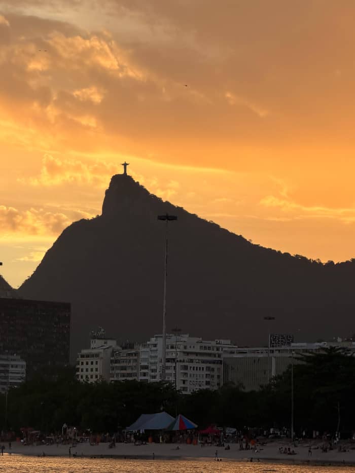
For photos, a phone is enough on a calm evening, but a polarizing filter or a camera with a fast lens helps once the light fades. Shoot Sugarloaf on the way out, when the light is still bright, and save the skyline for the return, when the Christ the Redeemer statue on Corcovado, a hill the federal government gives as 709 meters above sea level, stands out against the evening sky.22 Keep a cloth handy: spray from the bow fogs lenses quickly.
Above all, put the camera down at some point. The point of a boat trip in Rio de Janeiro is the feeling of the city rising from the sea all around you, with mountains, forest and buildings packed between the beaches. The moment to remember is often a quiet one, when the engine is low, the drinks are poured and the sky turns orange behind the hills: that is the moment that stays with you.
FAQ
A crew member meets guests at the marina's security gate and walks them to the boat.
The stops are photo and sightseeing stops; the swim at Santa Cruz is optional and weather permitting.
The statue stands on Corcovado, which the federal government gives as 709 meters above sea level.22
The route turns at Boa Viagem Island; the bridge stays on the horizon to the north.
The listing gives 15 minutes for the Sugarloaf photo stop.
Strong wind, currents, rain or the captain's decision can cancel the swim.
Oscar Niemeyer designed it; it opened on 2 September 1996.11
Sources
Planning a sail on the bay? Ask a real person.